EAST END 9+ ACRES
Jan-Feb 2012 used to identify boundaries and features on map below, and clean up trash in the area.
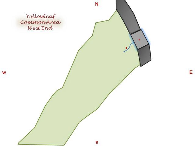
WEST END 4 ACRES
Property has been "walked" twice; boundary work and feature identification will begin this Spring.
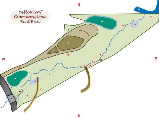
FEATURES
1 OLD ROADS
2 BRIDGE OVER SWEET GUM
3 BRIDGE CREEK
4 CREEKSIDE LARGE TREES
5 DRAINAGE DITCH
6 DRY CREEK
7 PATH ENTRANCE
8 PLATEAU BOULDERS & BRUSH
9 PLATEAU HILLS & SMALL PINES
10 PLATEAU ROAD
11 PROPOSED BENCHES
12 PROPOSED FOOT BRIDGES
13 PROPOSED PICNIC AREA
14 PROPOSED PLATEAU STEPS
15 PROPOSED SWING
16 STEEP HILLSIDE WITH FERNS
17 SUNKEN BEAMS PRIMITIVE BRIDGE
18 WALKING PATH NORTH CREEKSIDE
19 WET FROM DRAINAGE
20 WET WHEN RAINY
21 YELLOWLEAF CREEK
Disclaimer: this is an estimated map based on various area and feature measurements. Not a legal representation.
Disclaimer: this is an estimated map based on various area and feature measurements. Not a legal representation.
FEATURES
1 BRIDGE OVER SWEET GUM
2 BRIDGE CREEK